Fundy Park | Moosehorn and Laverty Falls Loop
Hello, hiking friends! Rumor here, your trusty Australian Shepherd trail guide! Today, I’m going to give you the scoop on our adventure through Fundy National Park to Laverty Falls. Trust me, it was paws-itively epic! We took the Moosehorn trail first, then connected to Laverty Falls Trail, making a big, muddy loop full of rivers, rocks, and waterfalls—my favorite things!
Trail Overview
Location: Fundy National Park, NB
Distance: Laverty Falls Trail 2.5km, Moosehorn Trail 4.5km
Difficulty: Moderate-Strenuous
Dog-Friendly: Yes! But leash required (ugh, park rules…)
Scenic Views: Waterfalls and riverbeds galore!
Trail Condition: Mostly well-maintained and clearly marked with yellow symbols. Watch out for some washout where Moosehorn meets the river, though—it’s easy to wander off-trail there.
On our way to the trailhead, something magical happened—right in front of our car, a rainbow appeared! I tried to catch it (obviously), but it slipped away once the rain started up again. It was still super cool. Can you believe a rainbow just chilling in the road? I swear it was real!
Even though it had been raining for three days, the parking lot was packed. I guess lots of folks were eager to hike. There are washrooms at the trailhead, which mom appreciated (though her face didn’t show it).
The Moosehorn Trail Experience
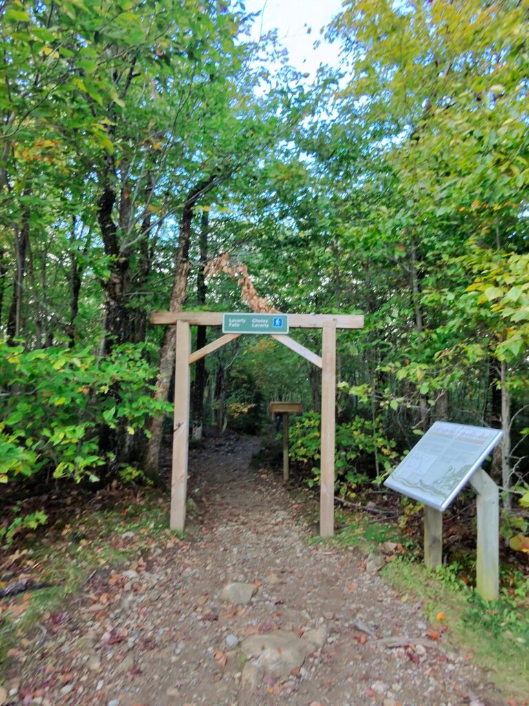
We kicked off on Moosehorn Trail, which has a beautiful wooden arch at the trail head with the trail name —like walking into a doggy adventure wonderland!
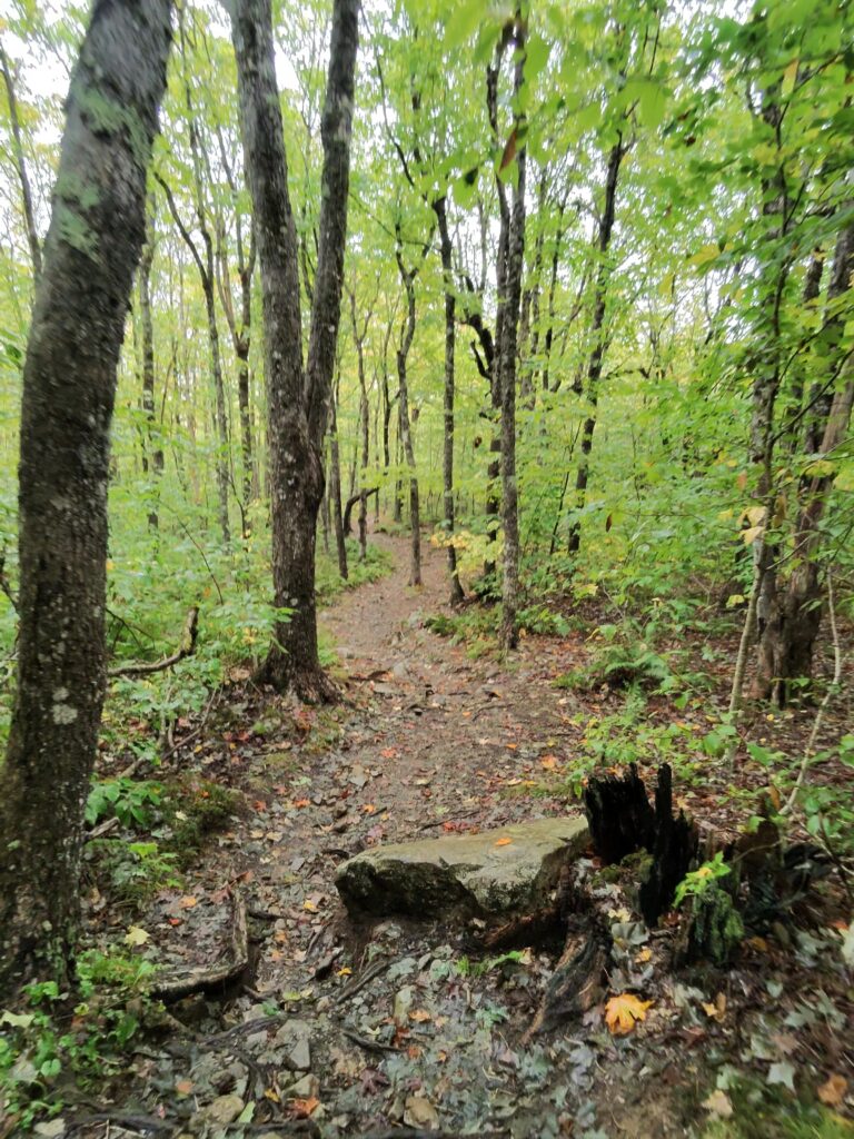
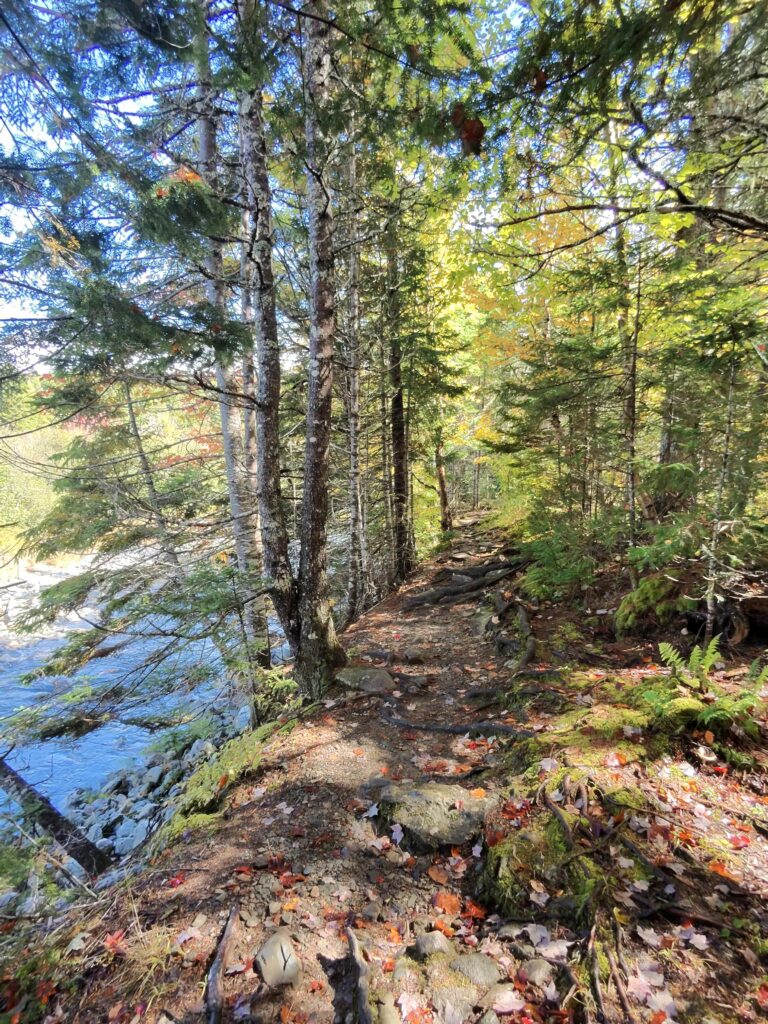
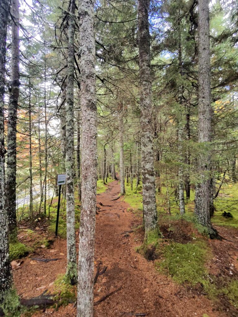
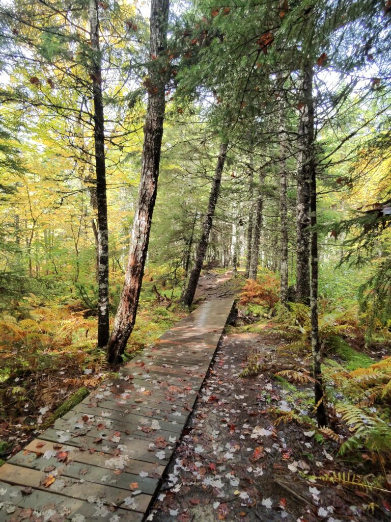
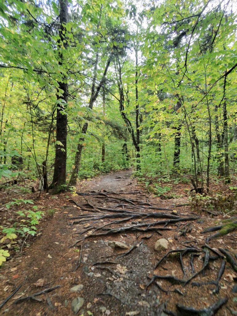
This trail goes through a mixed forest with mostly deciduous trees, so I could see humans and pups approaching. It is downhill to the river but the descent initially is very gentle. You’ll encounter plenty of roots and rocks as you go downhill—some sections are very heavily rooted and you will need to walk on the roots to get by. And in wet weather, oh boy, they get slippery. If you don’t have four paws like me, watch your footing!
About halfway through Moosehorn, the trail steepens. There are a few switchbacks to help with the descent, but it does narrow, so you might need to single file it. This is where we met a bunch of other hikers and their dogs (all leashed). We took a quick peek at a small waterfall via a side trail on the left at the top of the switchbacks—there was a line of people, so we didn’t linger, but it sure looked pretty!
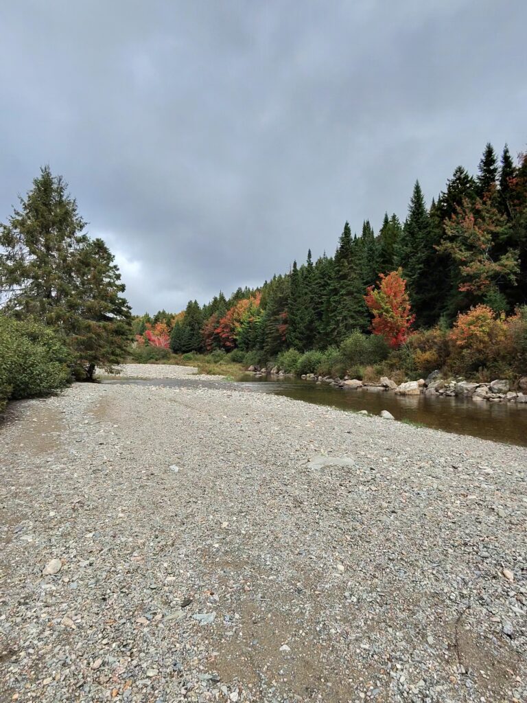
Broad River: The Real Show Begins
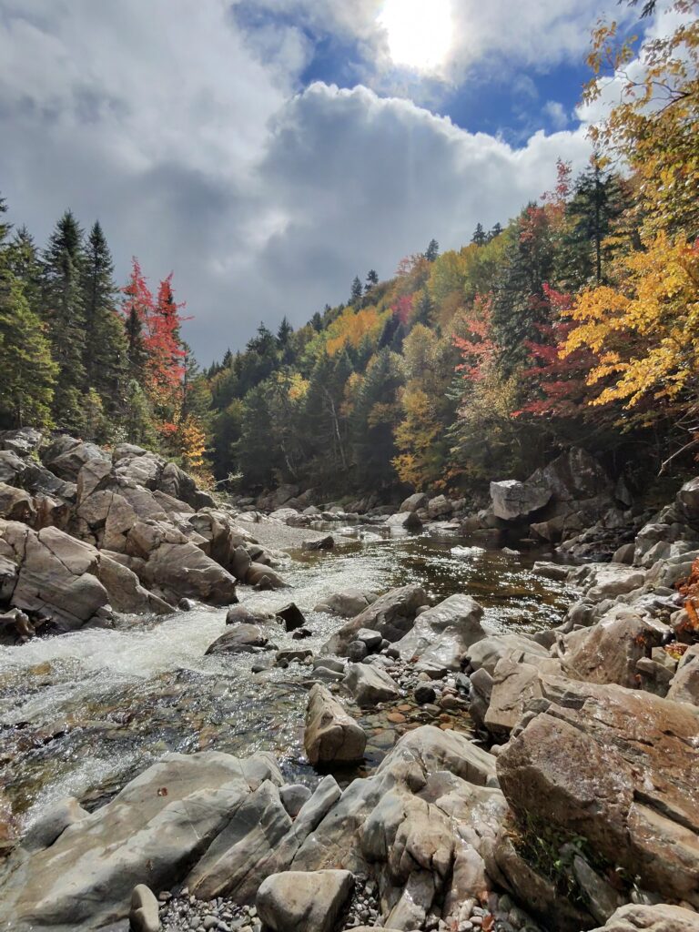
Now, THIS is where the adventure really kicks off! After you hit the river, take a short path on your right for some of the best river views you’ll ever see. The rocks here are huge, smooth and rounded like moose antlers (get it? Moosehorn trail!). There are mini waterfalls, turquoise-green pools, and plenty of spots to splash around. Some parts of the river are deep enough that you can jump off the rocks and into the river. I got to swim here! Only me though—mom and dad were not as excited to swim in the rain and the cooler September temperatures. Their loss! The scenery was breathtaking, with rocks and trees lining the river.
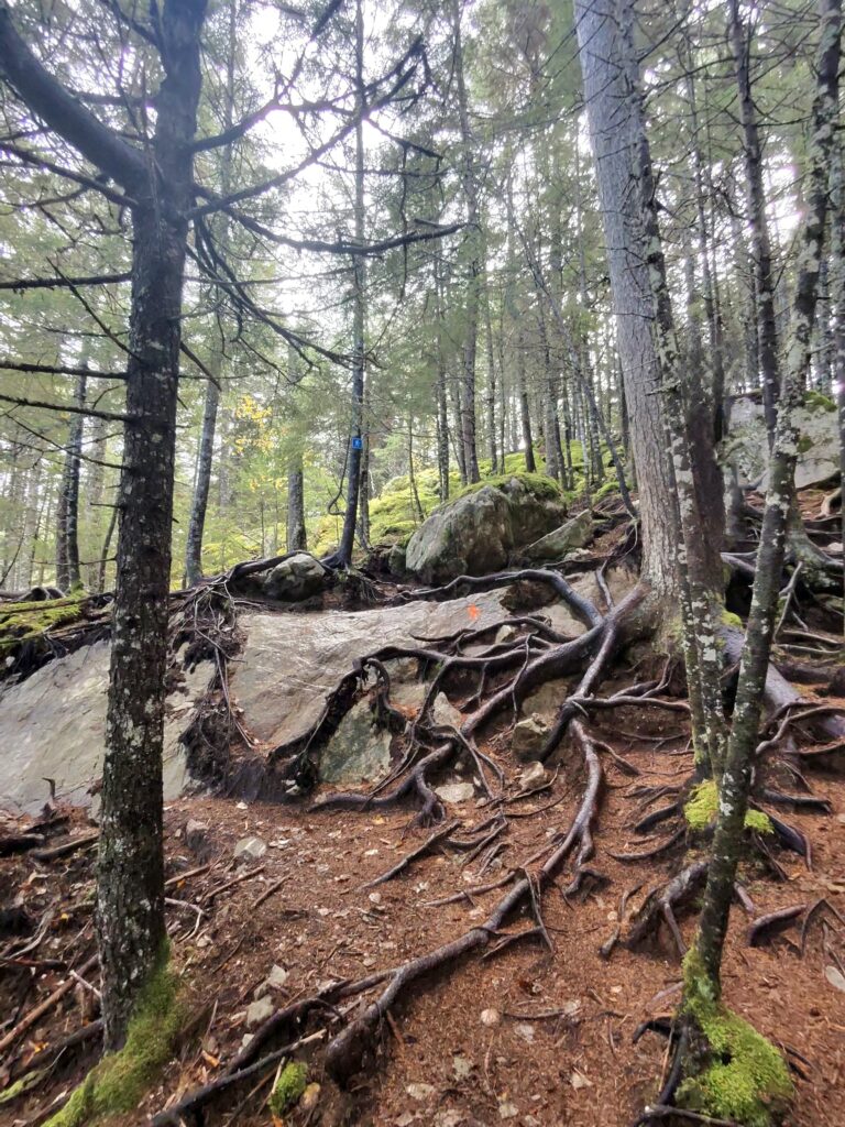
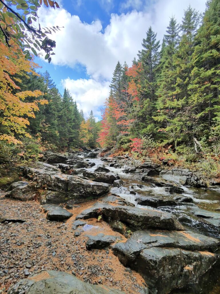
Once we finished swimming and snapping pics, it was back on the trail. And let me tell you—this is where the trail gets its strenuous rating. The part of the path is large rock, root-filled, and steeper, with some sections 6 or more feet high, requiring humans to use their feet and their hands to get through. Perfect for an energetic pup like me, but my older sister Keisha (she’s a 15-year-old Border Collie) would have had a hard time here, so she stayed home. This part of the trail isn’t for the faint of heart, but if you’re up for a challenge, it’s worth every pawstep.
Unfortunately, this area has some trail damage, with fallen trees and parts washed out or eroded. We saw several human-made paths that didn’t lead anywhere, so try as much as possible to stick to the main trail. It’s a bit confusing at times, but just keep your nose (or eyes, if you’re human) on the lookout for markers.
As we tried to find our way back to the main trail, Dad took a spill over a big rock—ouch! Don’t worry, he’s fine, just a bruised knee, but be extra careful navigating this rough patch.
After this short rough patch, the trail flattens out, following the river for a couple kilometers. This was my second favorite part! There were more opportunities to dip into the water, so we did just that. Mom played my favorite game—throw a rock into the river to her left, then to her right, repeat till I’m ready for a nap. I even caught some humans filming me! If I go viral, you heard it here first!
The trail ends at a junction with the Dobson Trail (across the river on the right) and the Laverty Trail.
The Laverty Falls Trail
We stayed on the Laverty Trail heading towards Laverty Falls. This part of the trail is much easier, with flatter ground and fewer roots. Just a short distance ahead is Laverty Falls, and what a sight!
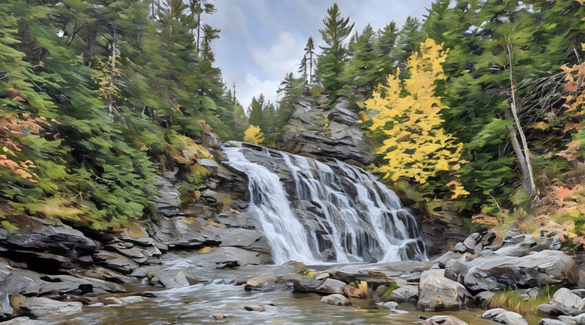
Laverty Falls is a curtain waterfall dropping 12 meters over an angled rock face. It’s the perfect spot for a picnic, photos, or a swim in the pool below the falls. We took some epic photos while the water roared in the background.
Fun fact: The Fundy Biosphere Reserve has recognized Laverty Falls and the falls at Moosehorn/Broad River on their top 50 amazing places in the region! How cool is that?
From here, we followed the trail back to the parking lot. Laverty is much easier on the paws than Moosehorn—gentle inclines, fewer roots and rocks, and only a few muddy spots. After three days of rain, it was still in great shape, though mom did break her dry-shoes streak. I, of course, fully embraced the wet spots and emerged from the forest covered in glorious black mud. It’s great for my coat—totally spa-worthy!
All in all, our hike measured about 8km, including a few side trips to check out rivers and waterfalls. A fantastic day of hiking, splashing, and exploring—what more could a dog ask for?
Rumor’s Rating

Rumor has it, this trail’s got it all—waterfalls, rocky rivers, and glorious mud! Bring your adventurous spirit (and maybe a towel for after).
Moosehorn Trail Pics
Laverty Trail Pics
Directions to the Laverty Falls and Moosehorn Trailheads
From Alma, enter Fundy National Park and drive about 7.4km until you see Laverty Road on your right. The road quickly turns to gravel, but it’s in good shape. Follow it for 5-6km, and you’ll arrive at a large parking lot. The Moosehorn and Laverty Falls trailheads are right there, ready and waiting!